Overview
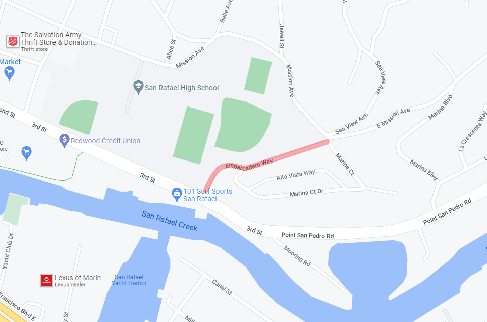
Embarcadero Way, located within the City of San Rafael, is a narrow street with a steep, vegetated drop-off on the north side of the street which is contiguous with the San Rafael High School property. This existing street connects 3rd St to the Montecito neighborhood, which is partially located in unincorporated Marin County; and mainly serves students and faculty from the nearby high school and provides access for the neighborhood. Embarcadero Way also provides direct driveway access for two of the homes located at the easternmost end of the street. Due to its location on the edge of City of San Rafael and Marin County jurisdiction, coordination with the County on the project will occur, as changes to Embarcadero Way might impact vehicle counts on County streets.
The narrowness of the street and allowance for two-way traffic results in vehicles often backing up into a driveway or until they approach a wider section of the street to allow vehicles to pass from the opposing direction. The narrowness of the street has contributed to , as reported by the Police Department and community.
In 2022, the City began outreach efforts by notifying neighbors of the and soliciting feedback on the chosen vehicle travel direction. The one-way direction was chosen based on the traffic volume counts taken on Embarcadero Way. Counts were also taken on adjacent streets that vehicles would be diverted to. Efforts for the project were stopped due to lack of capacity by the traffic team, but the project remained on the to-do list. Additionally, there were ongoing inquiries from SeeClickFix and the Police Department about the street. Once the traffic team was built back, it was decided that there was capacity to address this street.
Project Goals
- Improve roadway user and safety conditions on Embarcadero Way
- Minimize conflicts from occurring due to insufficient space for two-way traffic on Embarcadero Way
The pilot project aims to reduce vehicle-to-vehicle conflicts by circulating vehicles in one direction towards nearby streets, such as Mission Ave, Marina Court Dr, or Sea View Ave. To supplement previous data from 2022, pre-project traffic data will be collected following the start of the new school year in Fall 2025. Next, the pilot project will be implemented for a minimum duration of three (3) months. Community feedback and traffic data will be reviewed and considered for final project recommendations, which is anticipated to be available by mid-2026. Permanent implementation or closure of the street will be evaluated at the end of the pilot project, based on community feedback and the resulting diverted traffic volumes on nearby streets.
Timeline
| Pre-Pilot Data Collection and Outreach |
Fall 2025 |
| Pilot Project Duration |
Winter 2026 - Spring 2026 |
Impacts
The primary impact of this proposal is that traffic on Embarcadero Way will be diverted to Mission Avenue, Marina Court, or Sea View Avenue. The pilot project will study whether diverted traffic can be absorbed by the surrounding street network without any capacity or circulation issues.
Traffic volumes will be collected before and during the pilot project at all legs of the all-way stop-controlled intersection of Mission Avenue-Marina Court/Sea View Avenue, along with at the Embarcadero Way/3rd St intersection.
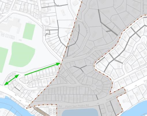
The image below shows the section of Embarcadero Way proposed for one-way conversion and locations for where traffic volumes will be collected.


")